


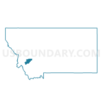
Precinct 10, Deer Lodge County, Montana
About
Outline

Summary
| Unique Area Identifier | 611935 |
| Name | Precinct 10 |
| County | Deer Lodge County |
| State | Montana |
| Area (square miles) | 334.96 |
| Land Area (square miles) | 334.13 |
| Water Area (square miles) | 0.83 |
| % of Land Area | 99.75 |
| % of Water Area | 0.25 |
| Latitude of the Internal Point | 45.98855790 |
| Longtitude of the Internal Point | -113.27224390 |
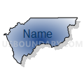
Maps


Graphs
Select a template below for downloading or customizing gragh for Precinct 10, Deer Lodge County, Montana


Neighbors
Neighoring Voting District (by Name) Neighboring Voting District on the Map
- Precinct 1, Deer Lodge County, MT
- Precinct 1, Ravalli County, MT
- Precinct 21, Beaverhead County, MT
- Precinct 23, Beaverhead County, MT
- Precinct 27S, Silver Bow County, MT
- Precinct 28, Silver Bow County, MT
Top 10 Neighboring County Subdivision (by Population) Neighboring County Subdivision on the Map
- Anaconda CCD, Deer Lodge County, MT (7,734)
- Philipsburg CCD, Granite County, MT (1,815)
- Sula CCD, Ravalli County, MT (1,362)
- Butte-Silver Bow Northwest CCD, Silver Bow County, MT (855)
- Big Hole Basin CCD, Beaverhead County, MT (615)
- Butte-Silver Bow South CCD, Silver Bow County, MT (349)
Top 10 Neighboring Place (by Population) Neighboring Place on the Map
Top 10 Neighboring Elementary School District (by Population) Neighboring Elementary School District on the Map
- Anaconda Elementary School District, MT (9,023)
- Ramsay Elementary School District, MT (1,265)
- Wise River Elementary School District, MT (291)
- Wisdom Elementary School District, MT (248)
- Divide Elementary School District, MT (180)
Top 10 Neighboring Secondary School District (by Population) Neighboring Secondary School District on the Map
- Butte High School District, MT (34,152)
- Anaconda High School District, MT (9,099)
- Beaverhead County High School District, MT (8,738)
Top 10 Neighboring Unified School District (by Population) Neighboring Unified School District on the Map
Top 10 Neighboring State Legislative District Lower Chamber (by Population) Neighboring State Legislative District Lower Chamber on the Map
- State House District 87, MT (9,798)
- State House District 72, MT (9,246)
- State House District 86, MT (8,842)
- State House District 73, MT (8,827)
Top 10 Neighboring State Legislative District Upper Chamber (by Population) Neighboring State Legislative District Upper Chamber on the Map
- State Senate District 36, MT (19,819)
- State Senate District 44, MT (19,665)
- State Senate District 37, MT (17,497)
- State Senate District 43, MT (17,466)
Top 10 Neighboring 111th Congressional District (by Population) Neighboring 111th Congressional District on the Map
Top 10 Neighboring Census Tract (by Population) Neighboring Census Tract on the Map
- Census Tract 8, Silver Bow County, MT (5,554)
- Census Tract 5, Deer Lodge County, MT (3,171)
- Census Tract 9617, Granite County, MT (3,079)
- Census Tract 3, Deer Lodge County, MT (2,967)
- Census Tract 1, Beaverhead County, MT (1,366)
- Census Tract 8, Ravalli County, MT (1,362)